

Rivers trail accessibility
We recognise that accessibility is not only about physical access. People experience the city and its rivers in different ways, depending on access, mobility and individual circumstances.
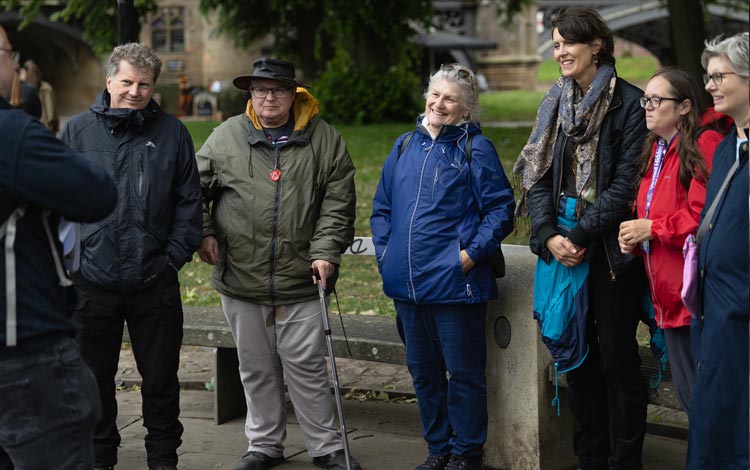
Exploring the trail in different ways
The York rivers trail can be explored in a range of ways. It is made up of a series of locations along the River Ouse rather than a single continuous route.
People experience the trail differently depending on access, mobility and individual circumstances.
You may choose to:
- visit one stop or several
- explore on foot, by wheelchair or mobility aid, by cycle or public transport
- engage with digital and creative elements, including Talk to the river
The trail is designed to be flexible. You are not expected to complete it in one visit. You don't need to follow a set route; you can choose the stops and order that work best for you.
Planning your visit
To help you plan your visit, we provide:
- a downloadable map you can 'zoom'
- step-by-step guidance between locations in our route notes
- information about access and nearby facilities
Getting around York Rivers Trail
Conditions along the river vary, they may include:
-
uneven or shared-use paths
- slopes, gradients or steps
- road crossings - including some without signals
- busy or narrow public spaces
Some routes involve major road crossings, for example, Water End. Where possible, use signal-controlled or marked crossing points.
We encourage visitors to:
- choose routes that suit their needs and confidence
- allow extra time where needed
- follow local signage
- use safe crossing points
Access at trail stops
Each stop is located within existing public spaces, so access varies by location. Where information is available, we provide details to help you decide whether a location is suitable for your visit.
- Seating is available at all trail stops
- Surfaces and gradients differ between locations
- Toilet facilities are not part of the trail itself, but are available nearby in many areas - find public toilets in York and see detalis of changing places.
Information about additional support and facilities in York is available from www.livewellyork.co.uk.
Weather and river conditions
Riverside paths can flood. Conditions may change after heavy rain or high river levels; always check flood levels.
Before travelling, please:
- check weather conditions
- allow for possible changes to your route
- take extra care near water and on shared paths
Route notes between stops
Route notes provide step-by-step guidance between nearby trail locations. They are designed to support people who prefer more detailed directions, including some blind and partially sighted visitors. They describe 1 suggested way to travel between nearby York rivers trail stops. The trail is still flexible - you can choose the stops and order that suit you.
- Homestead Park to Leeman Park
- Leeman Park to Museum Gardens
- Museum Gardens to North Street Gardens
- North Street Gardens to Tower Gardens
- Tower Gardens to Rowntree Park
Homestead Park to Leeman Park
This route works best going from north to south. This is the safer direction because it avoids asking people to cross Water End on the way out of Homestead Park. If you travel the other way, you may need to cross Water End at a signal or crossing point. The Water End entrance at Homestead Park is level and step free.
- Start at Homestead Park and leave by the Water End entrance. This entrance is level and step free.
- Make your way towards Clifton Bridge and the riverside path. This part of the route is mostly flat, but some bridge approaches can slope.
- Join the path and head south, with the river on your left.
- Keep going until the path ends, goes downhill and joins Lincoln Street. Continue straight ahead.
- At Salisbury Terrace, turn left and continue.
- Continue straight as Salisbury Terrace becomes Jubilee Terrace, then continues towards Cinder Lane.
- Keep following the route through Leeman Park towards Scarborough Bridge. The York rivers trail “stop” is in the Leeman Park area near Scarborough Bridge but please enjoy the full park.
Short note: This route starts beside the river and then moves onto local streets. Some parts may flood after bad weather, and extra care is needed at road crossings.
Leeman Park to Museum Gardens
- Start in Leeman Park on the paved riverside path.
- Head south towards Scarborough Bridge. Keep the river on your left.
- Go up to Scarborough Bridge and use the bridge to cross the river. The bridge approach has a slope.
- After the bridge, follow the route towards Marygate and Museum Gardens.
- Enter Museum Gardens. The gardens are free to enter.
Short note: most of this route is on tarmac, but parts of the riverside can flood.
Museum Gardens to North Street Gardens
- Start at Museum Gardens and leave by the Museum Street side.
- Go to Lendal Bridge and cross the river.
- When you are over the bridge, follow the way to North Street.
- North Street Gardens is beside the river on North Street. It has seating and step-free access.
Short note: Museum Gardens has some steep sections inside the gardens, so choose the smoother path where you can.
North Street Gardens to Tower Gardens
- Start at North Street Gardens.
- Walk towards Skeldergate Bridge, along Skeldergate.
- Use the crossing and go over Skeldergate Bridge.
- At the far side, go into Tower Gardens near Clifford’s Tower. Tower Gardens has benches and step-free access.
Short note: this section is more city street than park path, so take extra care at road crossings.
Tower Gardens to Rowntree Park
- Start at Tower Gardens near Clifford’s Tower.
- Follow the riverside path and cross Blue Bridge over the River Foss.
- Keep going along New Walk.
- Stay on this riverside path until you reach Millennium Bridge.
- Cross Millennium Bridge.
- Rowntree Park is just after the bridge. Use the entrance on the park side. Rowntree Park has accessible toilets and level tarmac paths through most of the park.
Short note: this is a popular shared riverside route. It can be muddy or flood in wet weather.
Making your own trail
The York rivers trail is designed to be flexible and inclusive. You are not expected to complete the full trail in 1 visit.
We encourage all visitors to:
- choose the stops that work best for them
- explore at their own pace
- come back another time to visit other locations if they wish
Feedback and continuous improvement
We're committed to improving accessibility over time.
If you experience any barriers, notice an accessibility issue at a trail stop, or have suggestions to improve the trail, we welcome your feedback.
Please email: yorkriverstrail@york.gov.uk
Your feedback will help us review and improve accessibility across the trail over time.